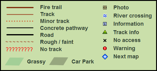
The following pages contain maps of bush tracks around Sydney, most of them
inside national parks.
Use the “back” button on your browser to return to this page,
or click on the
“next map” icon
![]() to view an adjacent map.
to view an adjacent map.
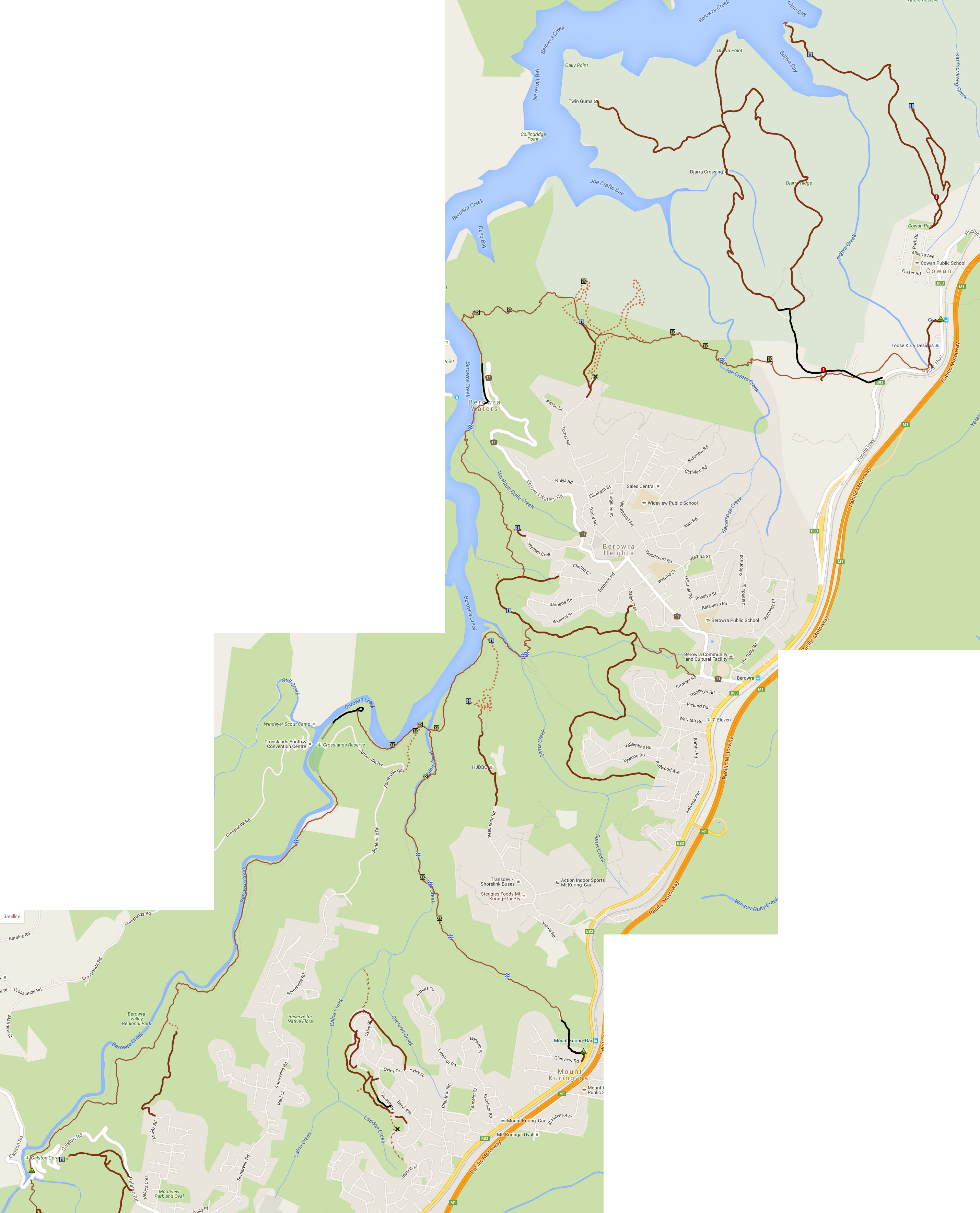
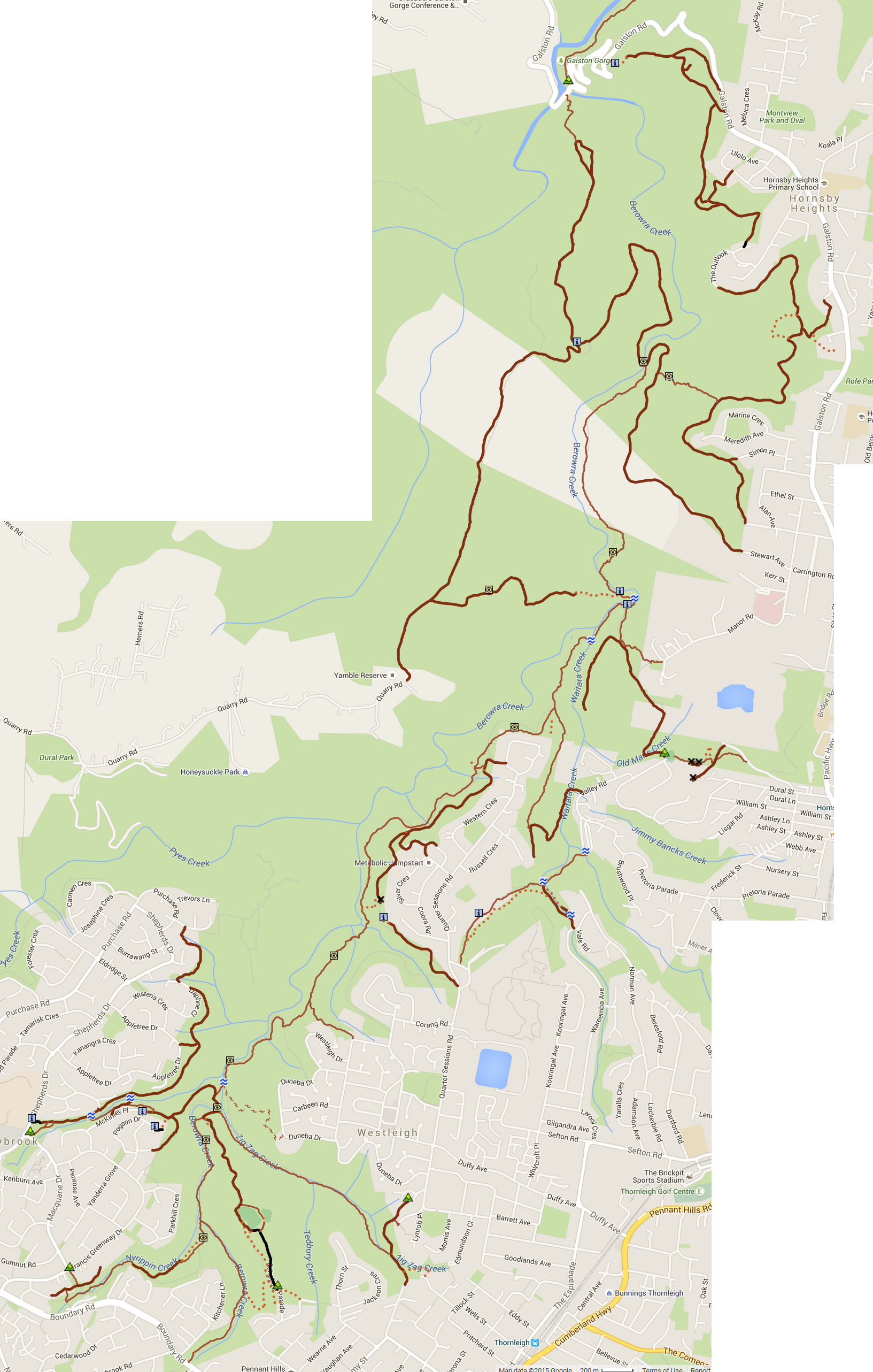
| Berowra Valley | ... Dural, Cherrybrook, Westleigh, Hornsby, Galston, Mt Ku-ring-gai, Berowra, Cowan |
| Botany Bay | ... La Perouse, Cronulla, Kurnell |
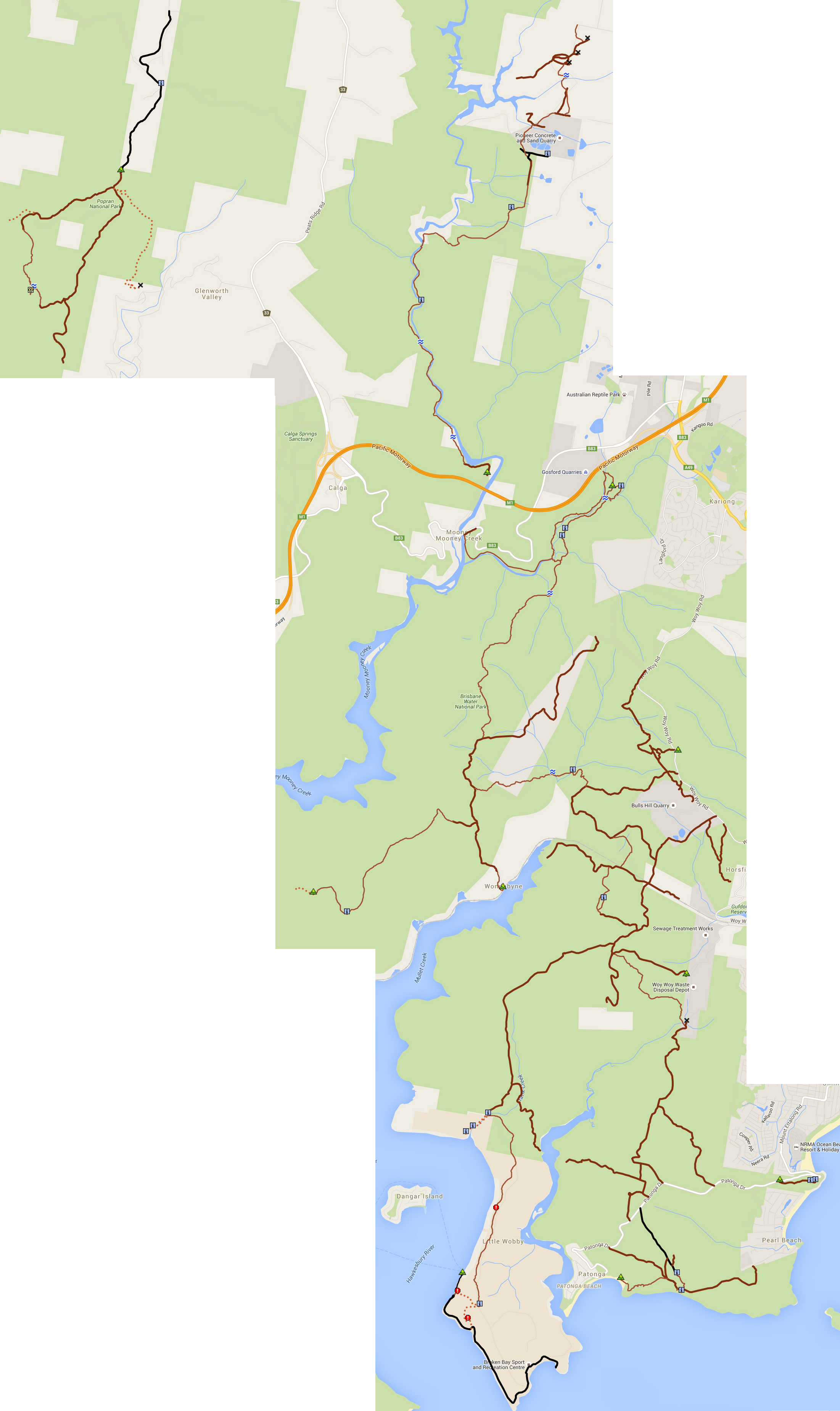
| Brisbane Water / Popran | ... Calga, Mount White, Patonga, Woy Woy |
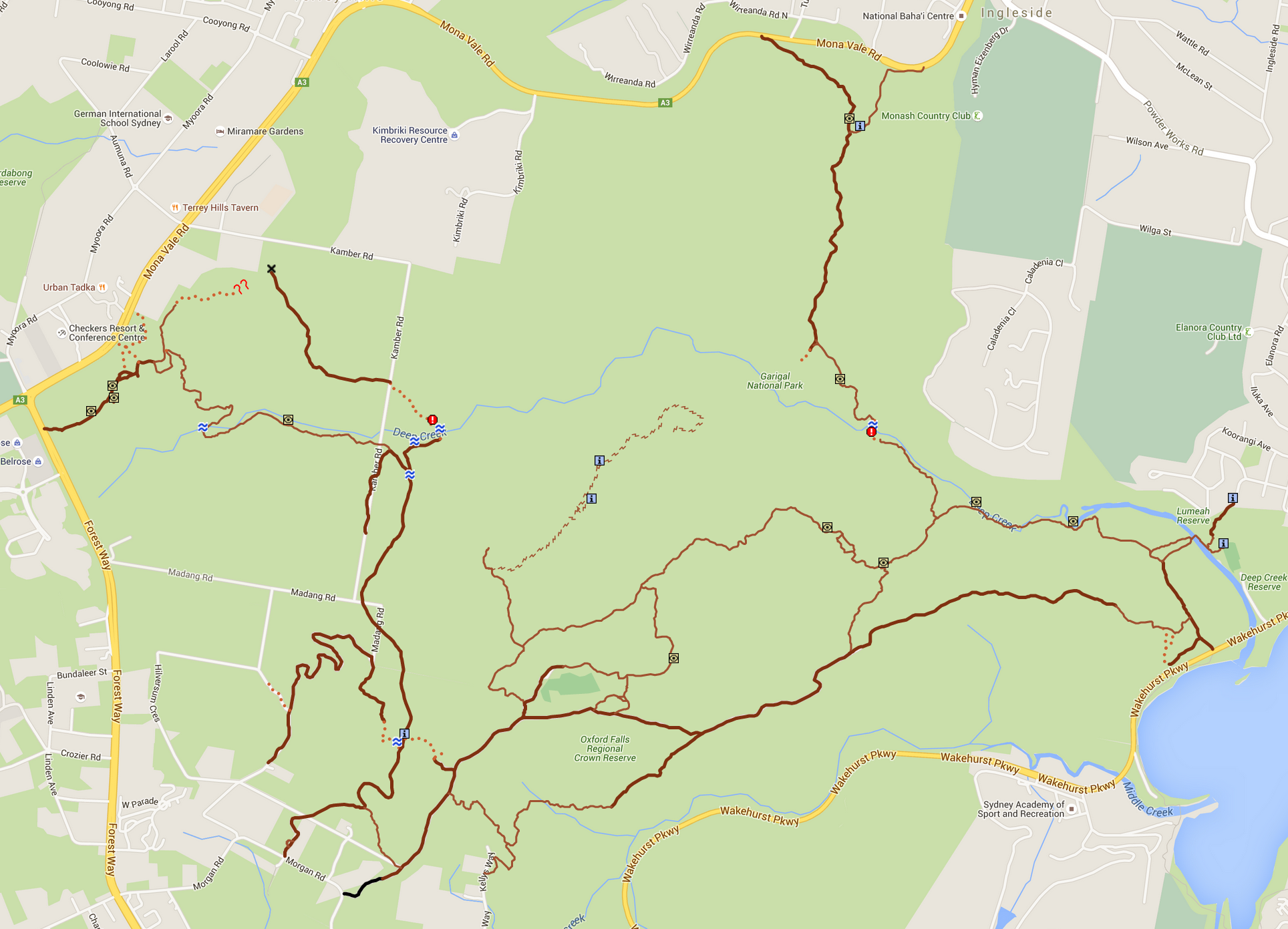
| Garigal East | ... Belrose, Oxford Falls, Elanora Heights, Ingleside |
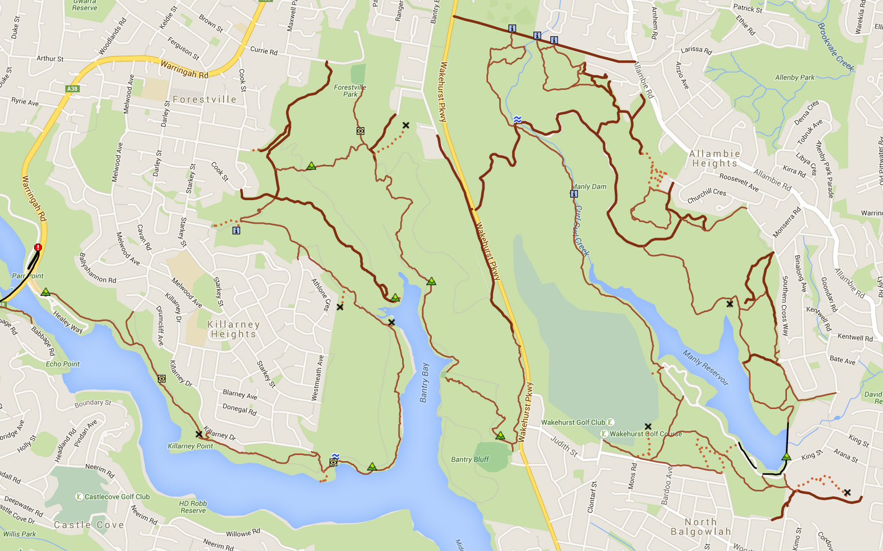
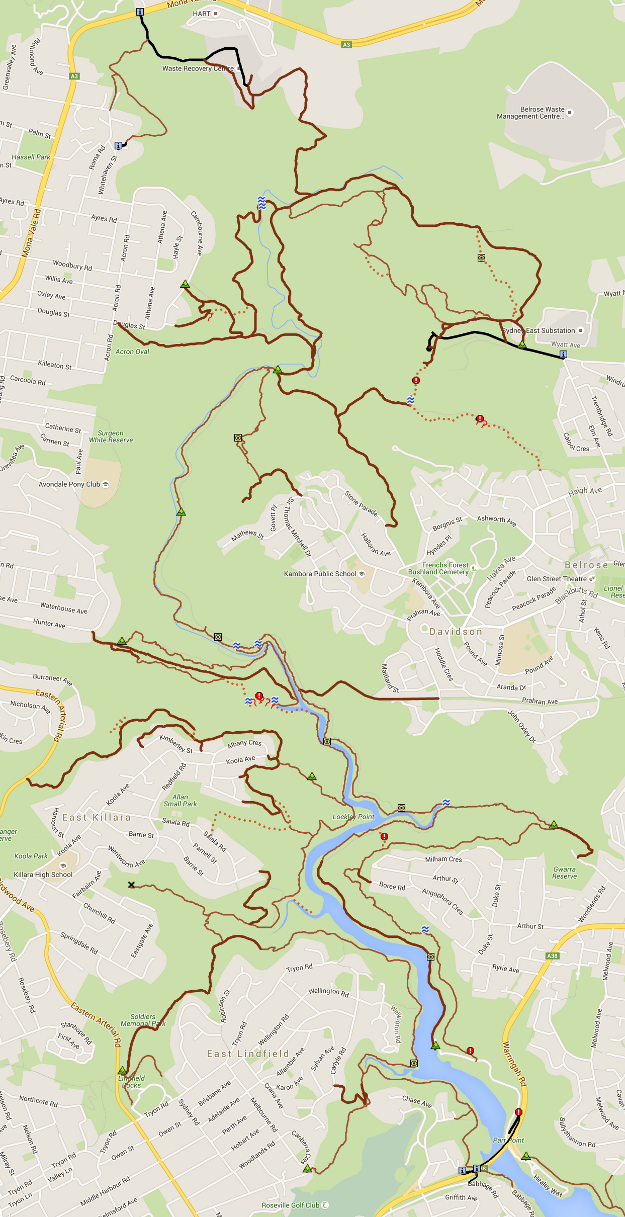
| Garigal West / Manly | ... Forestville, Killarney Heights, Roseville, Lindfield, Killara, Davidson, Allambie Heights, Manly |
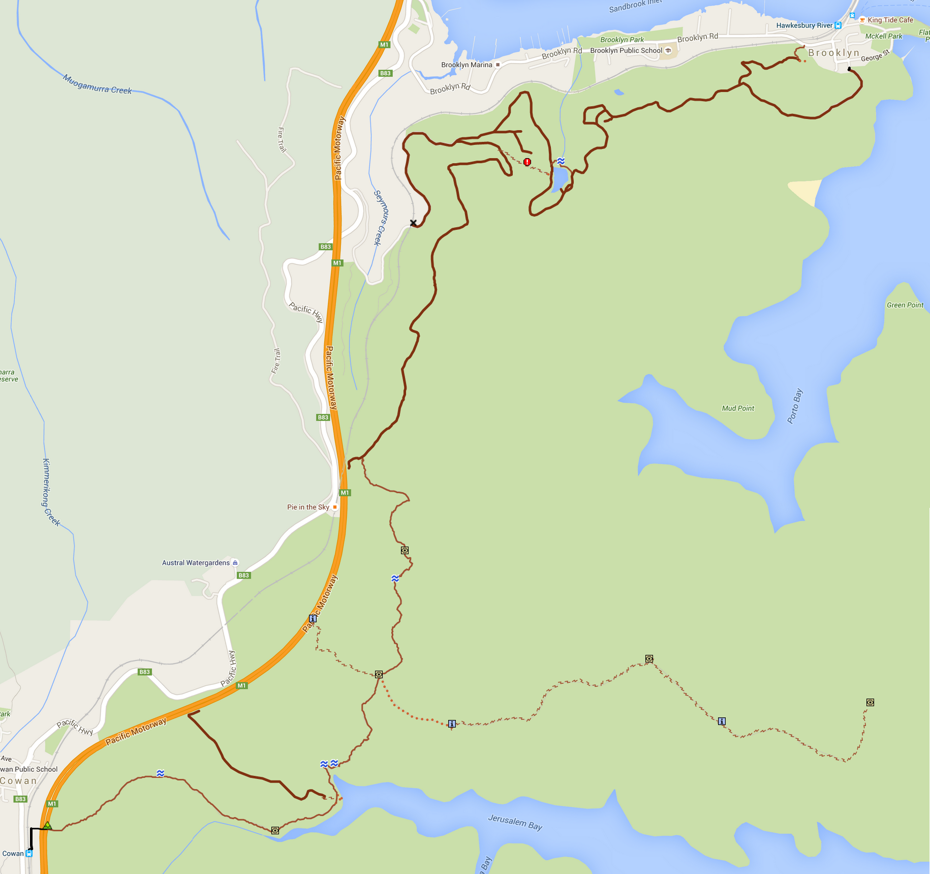
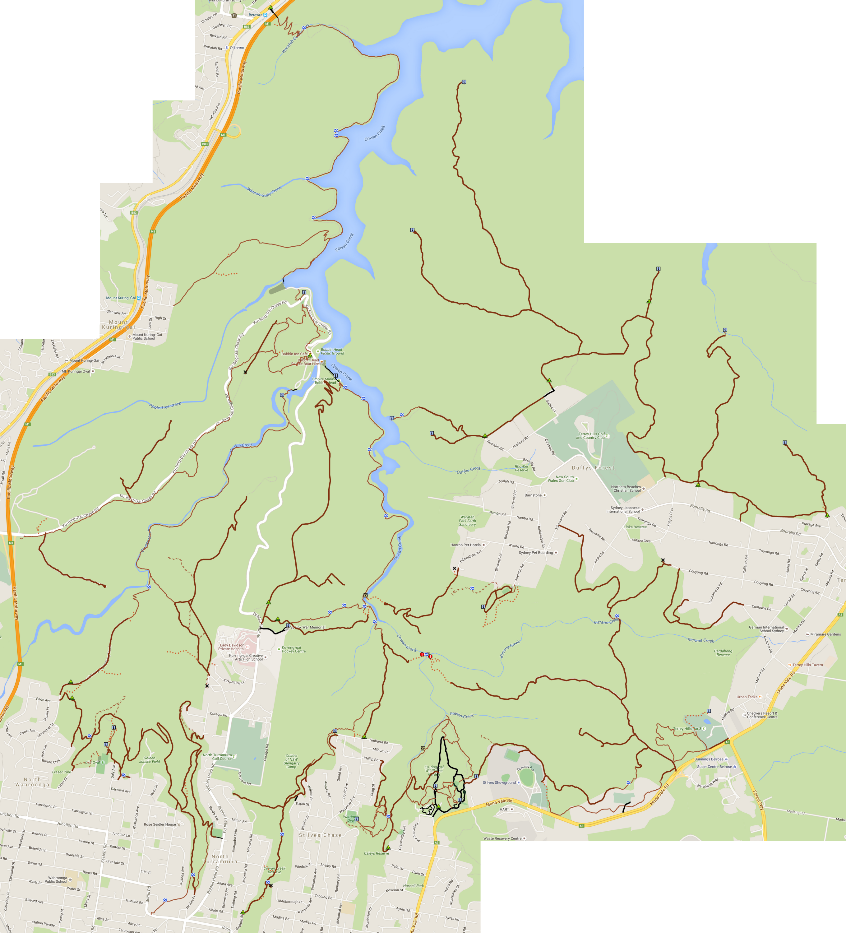
| Ku-ring-gai Chase | ... N. Wahroonga, N. Turramurra, St Ives, Terry Hills, Mt Ku-ring-gai, Berowra, Cowan, Brooklyn |
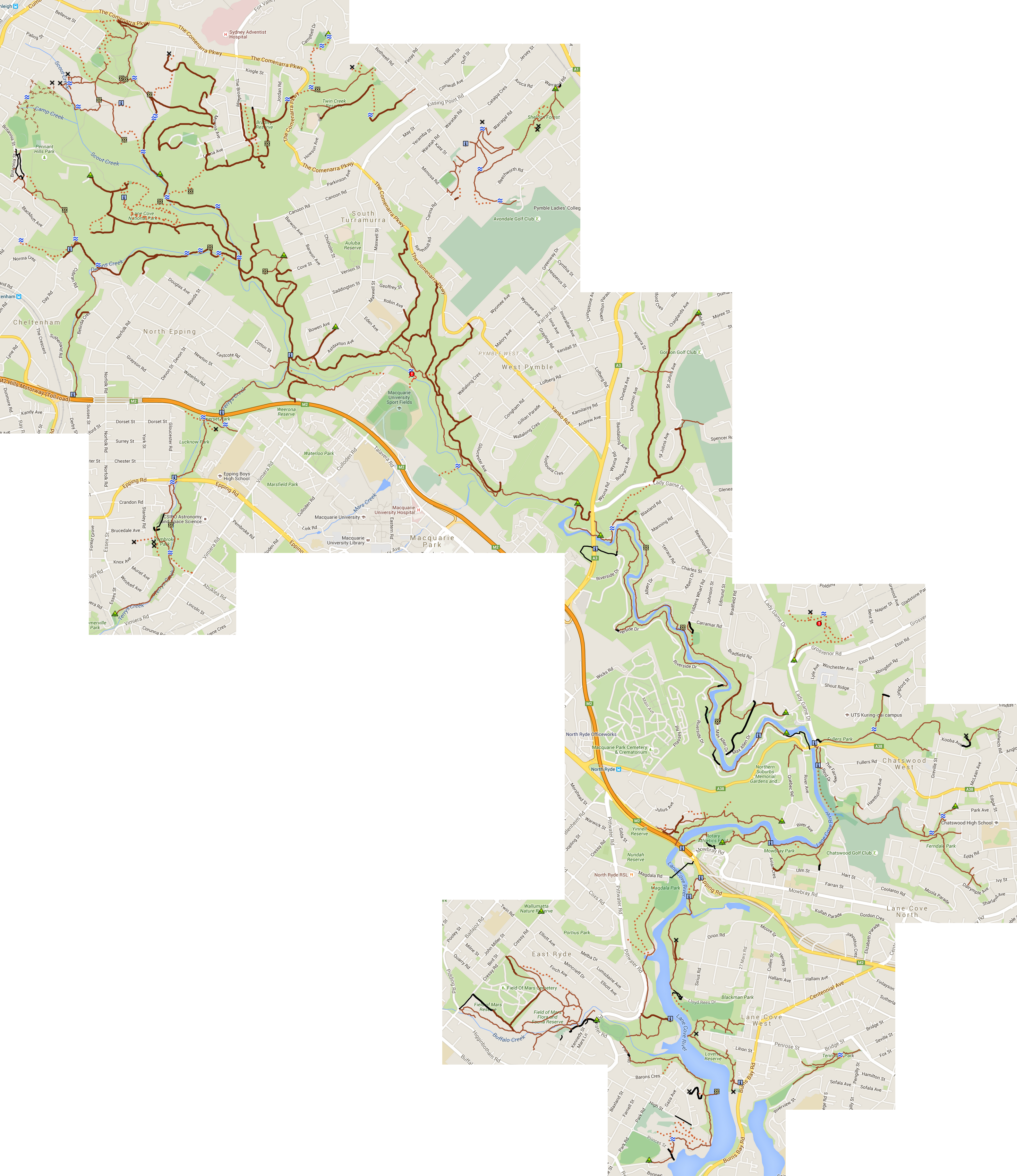
| Lane Cove | ... Lane Cove, Chatswood, Roseville, Macquarie Park, Wahroonga, Pennant Hills, Thornleigh |
| Royal National Park | ... Engadine, Heathcote, Waterfall, Helensburgh, Bundeena |
There is an Android app called Custom Maps which lets you use any image as a map. Here are images of some of the above areas for offline use (1-5 M each): Berowra North, Berowra South, Brisbane Water, Brooklyn, Forestville / Manly, Garigal East, Garigal West, Ku-ring-gai Chase West, Lane Cove.
Some tracks outside Sydney:
Blue Mountains
Bungonia State Conservation Area
Wollemi, Dharug & Gardens of Stone National Parks
This is a work in progress; tracks shown in green have not been “cleaned up” yet.
Send questions or comments to davidfisher@australiaonline.net.au.